
Get to Know Tenmile Lakes
Current conditions, boater safety, watershed facts and resources for everyone who lives on, plays on, and cares for Tenmile Lakes.
The Watershed
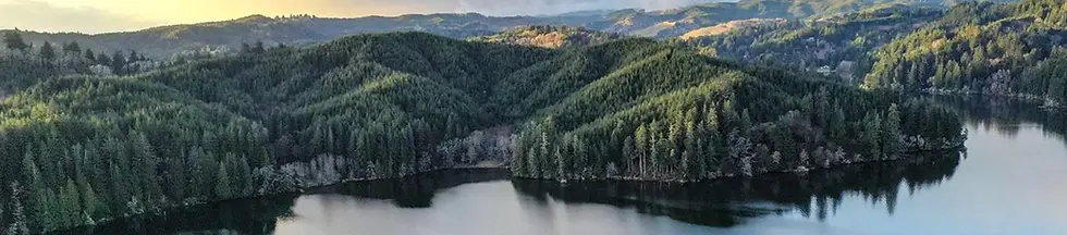
The Tenmile Lakes watershed covers approximately 98 square miles (62,720 acres). There are ten lakes within the watershed with a combined surface area of about 4.7 square miles (3008 acres) or 5% of the watershed. These lakes and their drainages, together can be divided into three sub-basins.
The Tenmile watershed is predominantly forested uplands. Since these forests cover the majority of the drainage, they intercept most of the rain that falls within the watershed, and so act as the catch basin for the entire watershed. Most of the steep upper forested slopes and their forested headwater streams are found within the Elliott State Forest and are managed by the Oregon Department of Forestry. The Elliott State Forest covers approximately 33.6 square miles (21,504 acres), making the State the largest single landowner within the watershed. Privately owned forestland covers approximately 23.2 square miles (14,837 acres).
98
Sq Mi
Watershed (62,720 acres)
5%
Lake surface: 4.7 square miles (3,008 acres)
10
Lakes in the watershed
33.6
Sq Mi
Elliot State Forest within the watershed


Tenmile Lakes: Water Conditions
- LAKE LEVEL
7.87 ft
Above Mean Sea Level (MSL)
Updated: Nov 14, 2026 at 3:00 PM PT
- WATER TEMPERATURE
57.0°F
Lake Basics
The Tenmile Lakes watershed covers approximately 98 square miles (62,720 acres). There are ten lakes within the watershed with a combined surface area of about 4.7 square miles (3008 acres) or 5% of the watershed. These lakes and their drainages, together can be divided into three sub-basins.
The Tenmile watershed is predominantly forested uplands. Since these forests cover the majority of the drainage, they intercept most of the rain that falls within the watershed, and so act as the catch basin for the entire watershed. Most of the steep upper forested slopes and their forested headwater streams are found within the Elliott State Forest and are managed by the Oregon Department of Forestry. The Elliott State Forest covers approximately 33.6 square miles (21,504 acres), making the State the largest single landowner within the watershed. Privately owned forestland covers approximately 23.2 square miles (14,837 acres).
Location
Tenmile Lake is located on the Oregon Coast between Reedsport and Coos Bay in the little town of Lakeside.

Lakeside, Oregon: Weather Conditions
- CURRENT TEMPERATURE
57°F
- WIND DIRECTION (from)
S
- WIND SPEED
15 mph
- HUMIDITY
63%
Updated: 4:15 PM PT

Home Owner Information
DIY Lake Weed Barrier
Alan Whitney (President Emeritus) of the Tenmile Lakes Association gives step-by-step instructions on how to build a lake weed barrier to prevent weeds from growing near your docks and/or swimming spots on the lake.
Here is a list of the supplies you will need:
-
4 - 10' sections of 3" PVC Pipe
-
4 "T" PVC pipe connections
-
PVC cleaner and glue
-
Zip ties (10-11")
-
Hemostat Twine (optional - will need if connecting two weed barriers together)
-
Rope (nylon or other synthetic) for weed barrier retrieval/move
-
BBQ Lighter (to burn several small holes for air release as you sink the barrier)
-
Long wood pole(s) to help place the weed barrier
-
Boat or kayak - you will need a second person in the boat to help place the barrier
-
Saw Knife (or scissors)
If you have questions on how to build your own lake weed barrier, contact Alan at the Tenmile Lakes Association at tenmilelakes@gmail.com.

Live on the Lake? - Post Your Address Prominently
Please be sure to have your lake address posted boldly and prominently on your dock or boathouse. In the event of an emergency, this will help the fire department locate you when they arrive via boat. Numbers should be large and of a contrasting color to the dock or boat house. If you have numbers that will show up in the dark, that is even more beneficial to being found at night.

To have a free septic dye test, please contact Mike Mader at TLBP - tenmile.wsc@gmail.com
For more information on the Septic System Service Assistance, please contact Alan Whitney (President Emeritus) at whitneyalan9@gmail.com.
Tenmile Lakefront Homeowner Septic Assistance
Presented by the Tenmile Lakes Association & Tenmile Lakes Basin Partnership
Evidence shows that one of the factors for algae blooms in the summer on Tenmile Lake is poorly functioning wastewater treatment around the lake. There are some that are not registered with DEQ and some that have not been maintained properly.
The Tenmile Lakes Association (TLA) and Tenmile Lakes Basin Partnership (TLBP) have provided technical assistance for years to lakefront homeowners. They have also encouraged homeowners to have their septic systems evaluated to be sure they are functioning properly.
TLBP will check the continuity of your system with a dye test - free of charge. TLA has also set aside funds to reimburse lakefront homeowners for a portion of the cost to have their septic systems located, evaluated, and pumped. TLA will reimburse homeowners (up to $250) who provide a receipt from a licensed septic professional identifying the work completed and the cost.
For homeowners to receive assistance, their septic system installations must be from 1975 or earlier. TLA will assist the first 12 homeowners to submit valid receipts for service. If you are unsure when your septic system was installed, check with DEQ.
This program is voluntary and confidential.
